Kyiv Shelter Map
Where to find the nearest shelter in Kyiv: the official shelter map and a short guide for visitors.

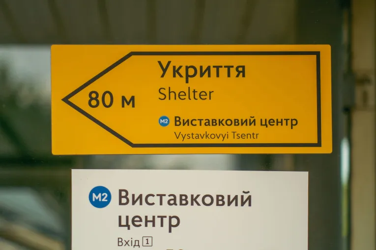
You can find the nearest shelter on the below map by Kyiv Rescue Service. It shows different types of shelters across the city, including metro stations, underground passages, parking garages, basements of residential buildings, and other shelter spaces.
The map shows basic information about each shelter, such as its type, size, capacity, and whether it is open to the public. However, it does not show what the shelter looks like inside or where exactly the entrance is.
That is why we recommend visiting the nearest shelter before your first air raid alert. Check whether it is open, how to get inside, and how long it takes to get there.
How to find the nearest shelter on the map
The map has many locations, so it may take a few seconds to load. If it opens slowly or freezes for a moment, just give it a little time.
From your phone
- On the website, tap the “View larger map” icon in the upper-right corner of the map.
- The map will open in the Google Maps app, if it is installed on your phone. You will see a regular map of Kyiv with shelter locations added to it.
- To find shelters near you, tap the “Your location” button. Google Maps will center the map on your current location and show nearby shelters.
- You can also search for your address, hotel, venue, or another location. The map will show that place and the shelters around it.
- Tap any shelter on the map to view its location and get directions.
Google Maps will open in the language set on your phone. Address search usually works best in Ukrainian or English.
From your computer
- On the website, click the “View larger map” icon in the upper-right corner of the map.
- The map will open in a new window in Google My Maps. On the left, you will see a panel with Kyiv districts and shelter types.
- To find shelters near a specific place, use the search field on the map. Enter your address, hotel, venue, or another location.
- The map will show the place you searched for. Zoom in to see the nearest shelters around it.
- To get directions to a shelter, click its marker on the map. In the panel on the left, click the directions icon. The shelter will then open in Google Maps, where you can choose your starting point and get directions.
Please note: detailed information inside the map, including shelter type, district, building type, area, capacity, and whether the shelter is open to the public, is available only in Ukrainian.
If the map is hard to use or you are not sure which shelter to choose, ask locals who live or work nearby. They may know details that are not shown on the map, such as whether a specific shelter is warm, whether it has a toilet or internet, and where the entrance is.
Do not hesitate to ask for help — people in Kyiv are used to helping each other in situations like this.
You can also always contact us with questions about safety in Kyiv. We will be happy to help you understand what to do and where to find up-to-date information.