
Kyiv metro map

The Kyiv metro has 52 stations across three lines: red (M1), blue (M2), and green (M3). The system is compact and clearly laid out, so it’s easy to navigate even if it’s your first time in the city.
This metro map will help you get around more easily.
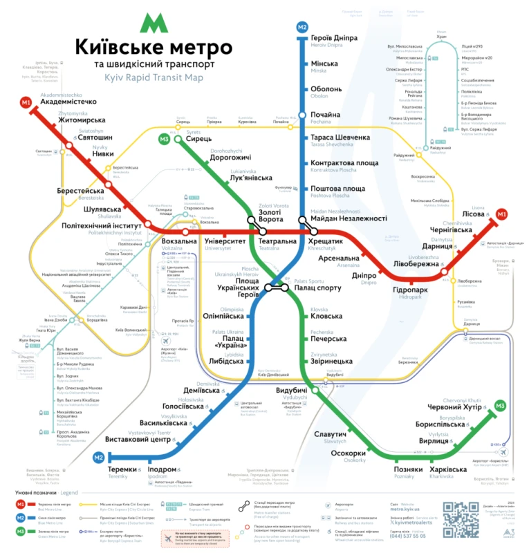
It shows in both Ukrainian and English:
- Metro lines and all stations;
- Transfer points between lines;
- Railway stations, bus terminals, and airports;
- Connections to the city ring train and high-speed tram lines, along with their route diagrams;
- The right and left banks of the Dnipro River.
Questions and answers about Kyiv metro map
The current Kyiv metro stations list includes 52 active stations across three lines.
- Red Line (M1): 18 stations from Akademmistechko to Lisova.
- Blue Line (M2): 18 stations from Heroiv Dnipra to Teremky.
- Green Line (M3): 16 stations from Syrets to Chervonyi Khutir.
To ensure you aren’t using an outdated Kyiv subway map, please note that several stations were recently renamed, such as Ploshcha Ukrainskykh Heroiv (formerly Ploshcha Lva Tolstoho) and Zvirynetska (formerly Druzhby Narodiv).
There are currently 52 Kyiv subway stations. While there are plans for a fourth line (Yellow Line/M4) and further expansions to the existing lines, the current metro kyiv map focuses on the three main lines that effectively connect the right and left banks of the city.